Case studies and examples of how citizens use climate data.
Case studies and examples of how citizens use climate data.
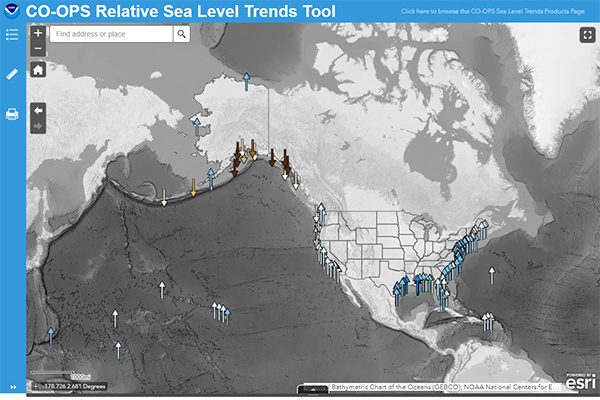
You can use a number of software packages and Web sites to to access or generate image maps or graphs of historical climate data or future climate projections.
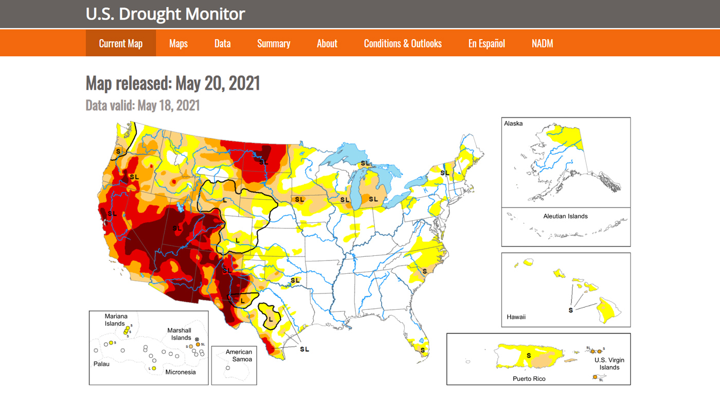
A weekly map—updated each Thursday—that shows the location and intensity of areas currently experiencing abnormal dryness or drought across the United States.

Essential climate & weather variables for use in epidemic modeling studies

The short-term state of the atmosphere is weather. Climate is a description of the long-term pattern of weather conditions.
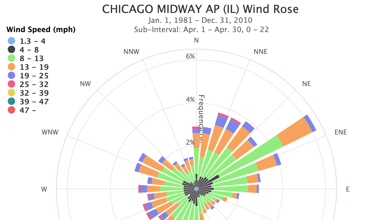
Wondering which direction the wind was from during your last cold snap, or which summer months usually have a breeze?
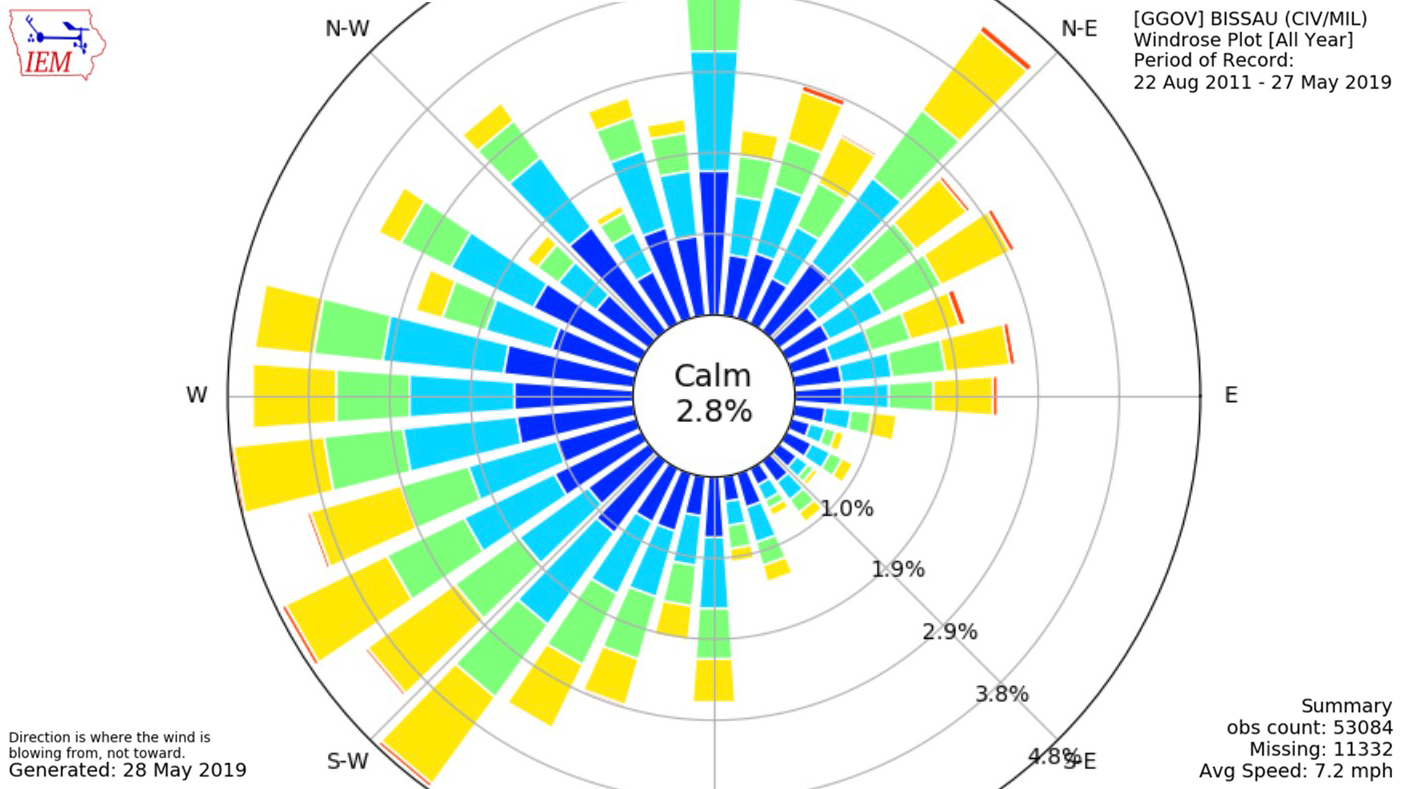
The Iowa Environmental Mesonet (IEM) lets you examine long-term records of wind speed and direction for many locations around the world.