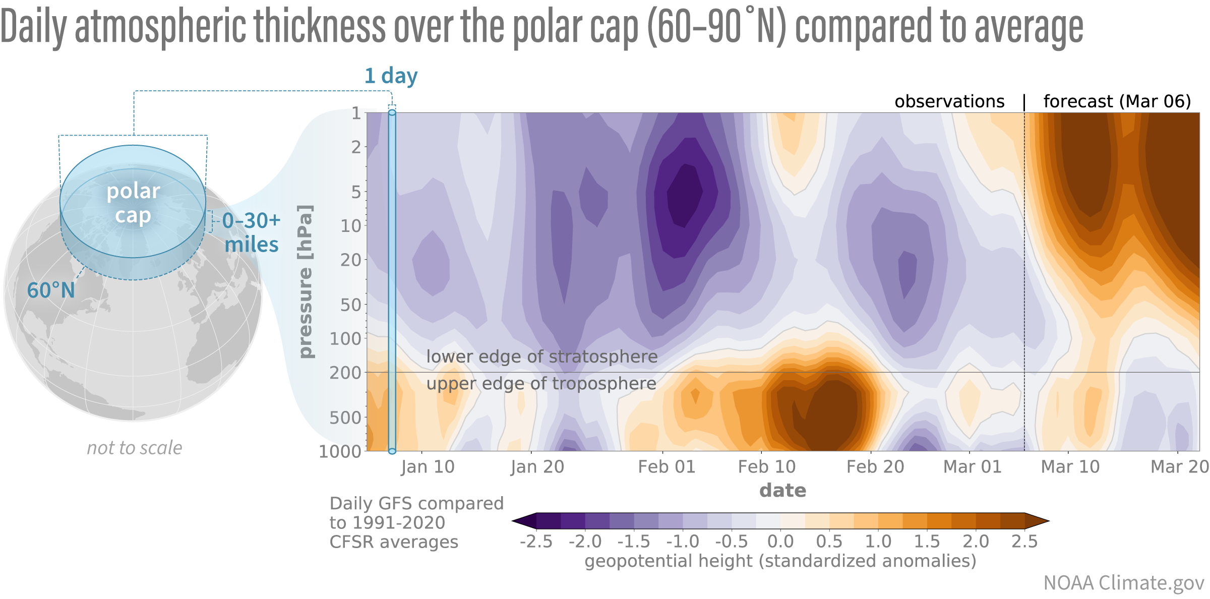
Differences from average atmospheric thickness (“standardized geopotential height anomalies”) in the column of air over the Arctic for the stratosphere and troposphere. Since the beginning of the year, low-thickness anomalies (purple shading indicative of a stronger than average polar vortex) have dominated the stratosphere but only periodically coupled down to the troposphere. Latest forecasts show a dramatic change with thickness anomalies increasing (orange shading), consistent with a polar vortex disruption. These stratospheric anomalies are preceded by tropospheric anomalies of the same sign, hinting at a nudge from below. However, it’s too soon to tell whether these stratospheric anomalies will then drip down into the troposphere again. Standardized anomalies are based on departures from the 1991-2020 Climate Forecast System Reanalysis climatologies and have been divided by the standard deviation. Data are from the Global Forecast System observational analysis and forecast.