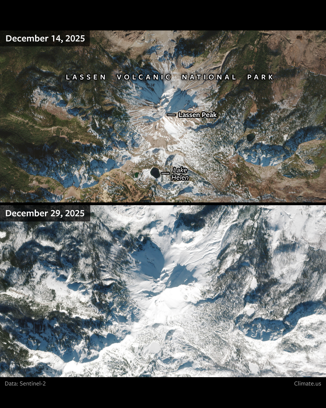
Three back-to-back atmospheric river events produced heavy rain over the Pacific Northwest and central California in late December 2025. A fourth storm carried the precipitation into the mountains, where it fell as snow. This pair of Sentinel-2 satellite images captures the snowy transformation of Lassen Volcanic National Park between December 14 and 29. Ten-day precipitation totals exceeded 15 inches in the southern Cascade Mountains, where the park is located. In the nearby Sierra Nevadas, snowpack increased from ~7–30% of normal to 57–100% of normal between December 22 and 27, according to the Center for Western Weather and Water Extremes.