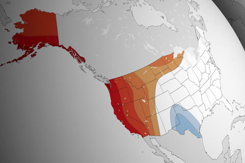
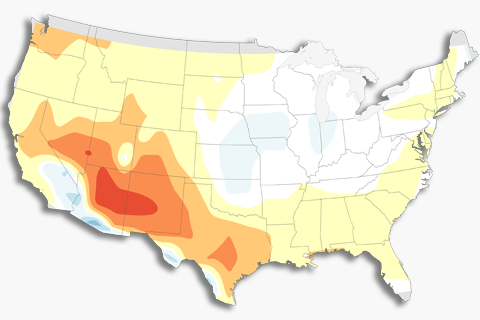
Moderate flooding in the coastal Northeast and temperatures in the upper third of the historical record for the West are key predictions from NOAA's 2015 Spring Climate Outlook.
Moderate flooding in the coastal Northeast and temperatures in the upper third of the historical record for the West are key predictions from NOAA's 2015 Spring Climate Outlook.
The United States has plenty of warming wiggle room before it gets too warm to snow, and a wetter atmosphere may boost snow totals for some storms.
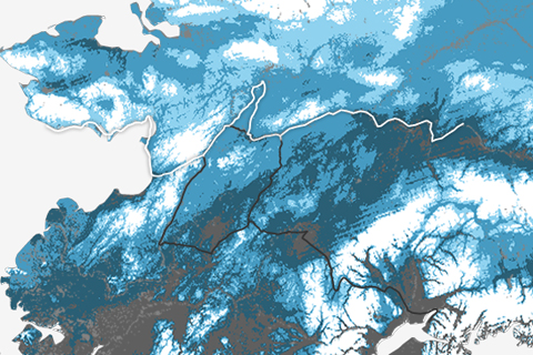
A map of snow depth across Alaska on March 9 shows the reason for the re-route of the historic sled dog race.
Guest blogger Dennis Hartmann makes the case that warm waters in the western tropical Pacific—part of the North Pacific Mode climate pattern—are behind the weird U.S. winter weather of the past two seasons.
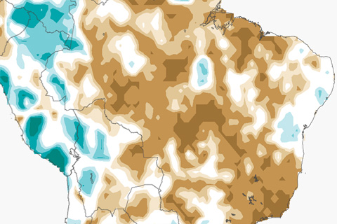
Government officials have already announced a potential water rationing program as well as expected blackouts to conserve electricity in case rains do not pick up. If they don’t, Brazil is almost certainly facing its driest back-to-back rainy seasons in at least 35 years.
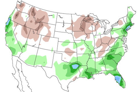
This pair of maps shows whether your state tends to have wet, dry, or average springs during El Niño, and how often the wet or dry pattern occurred during the last 10 El Niño years.
After a long watch, NOAA has issued an El Niño Advisory. What changed? And what does it mean for U.S. weather?
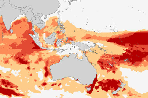
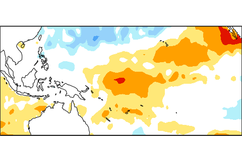
After a surprisingly rough summer for coral reefs in 2014, NOAA scientists are warning that warm ocean temperatures in the tropical Pacific and Indian Oceans could set the stage for a global outbreak of coral bleaching—the loss of corals’ food-producing algae—in 2015.
How do we verify forecasts that use probabilities? Read on to find out.
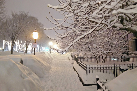
A stalled atmospheric set-up has made Boston and surrounding areas in the Northeast the most popular truck stop for storms travelling the atmospheric highway known as the jet stream. And stop they have, like a caravan of tractor-trailers idling in a rest stop parking lot.