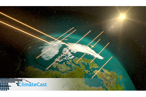
Jackie Richter-Menge describes the "Arctic amplification" phenomenon: how the loss of Arctic sea ice leads to further warming.
Jackie Richter-Menge describes the "Arctic amplification" phenomenon: how the loss of Arctic sea ice leads to further warming.
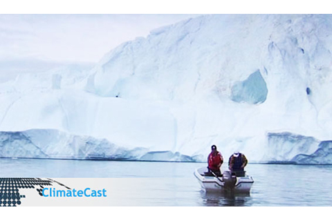
This year’s Arctic Report Card emphasizes that climate change is more prominent in the Arctic than at lower latitudes.
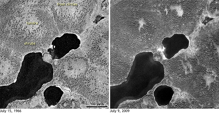
The Arctic of recent years—warmer, greener, less icy—is likely to be the new normal for the Far North. One sign of the ongoing transformation of the Arctic is the spread of shrubs across the tundra.
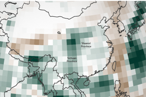
More than a week of torrential rain in mid-September 2011 caused deadly floods across Sichuan, Shannxi, and Henan provinces in China.
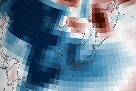
Cold weather settled over Japan and the Korean Peninsula in January 2011, and for the first time since 1986, Japan experienced below-normal January temperatures.
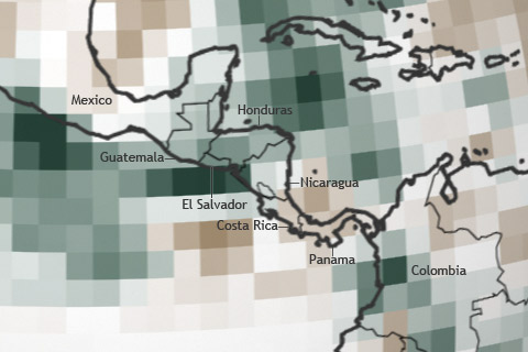
From October 10-20, 2011, two separate storm systems dumped nearly five feet of rain across southern Central America, causing flooding and landslides in several areas.
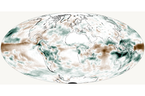
Seasonal precipitation patterns across the globe showed large differences from average in 2011, with several areas receiving heavy rains during more than one season of the La Niña-influenced year.
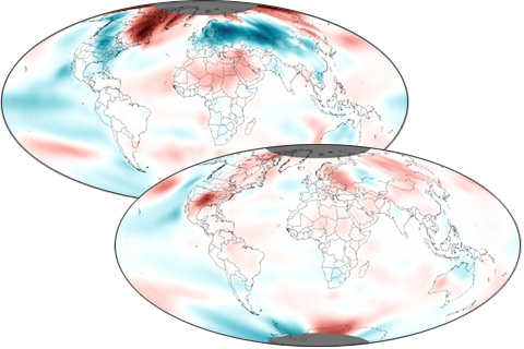
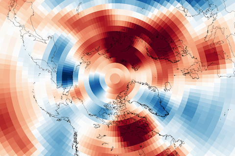
A year-long La Niña contributed to dramatic variability in seasonal temperature patterns in 2011.
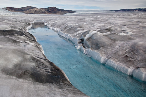
In the 2011 Arctic Report Card, scientists report that the bright white surface of the Greenland Ice Sheet has grown less reflective. The darker surface absorbs more sunlight, accelerating melting.
Climate forecasters often describe the Arctic Oscillation as the “wild card” of the winter forecast. So far in 2011, the Arctic Oscillation has been in its positive phase, playing the card that favors a milder winter in the eastern United States.