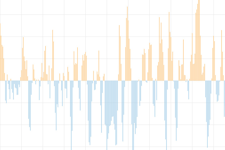
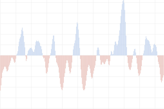
The North Atlantic Oscillation tracks a seesawing of surface pressure between two parts of the North Atlantic. Different phases often bring predictable changes in winds, temperature, and precipitation in the United States and Europe.
The North Atlantic Oscillation tracks a seesawing of surface pressure between two parts of the North Atlantic. Different phases often bring predictable changes in winds, temperature, and precipitation in the United States and Europe.
The Pacific-North American teleconnection pattern influences regional weather by affecting the strength and location of the East Asian jet stream, and subsequently, the weather it delivers to North America.
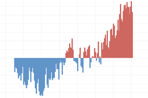
Global average sea level has risen at least 8-9 inches since 1880, and the rate is accelerating thanks to glacier and ice sheet melt.
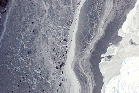
Antarctic sea ice extent hit a record low extent in February, but thanks to large natural variability from year to year, experts say there is still no long-term trend.
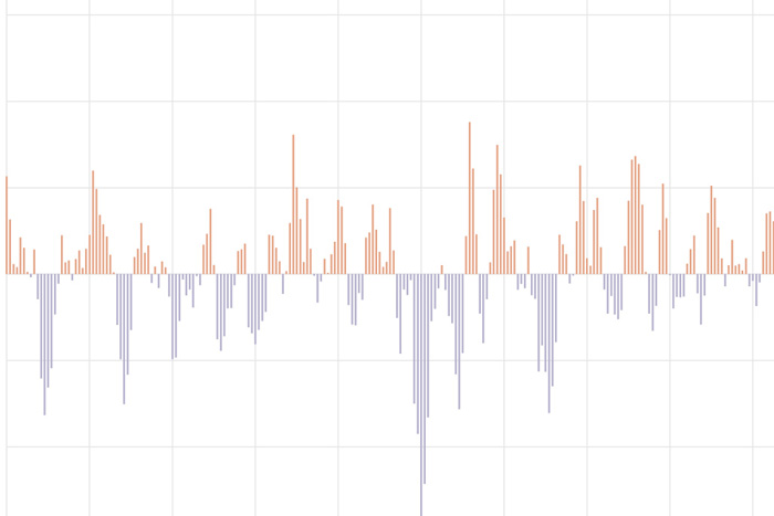
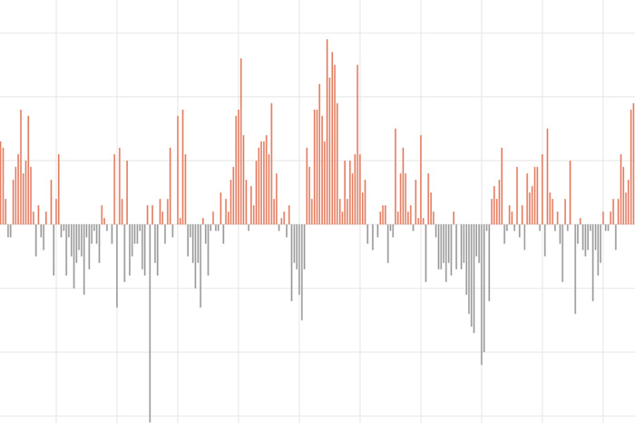
The Relative Oceanic Niño Index tracks sea surface temperature in the east-central tropical Pacific Ocean. It is NOAA's primary indicator of El Niño and La Niña.
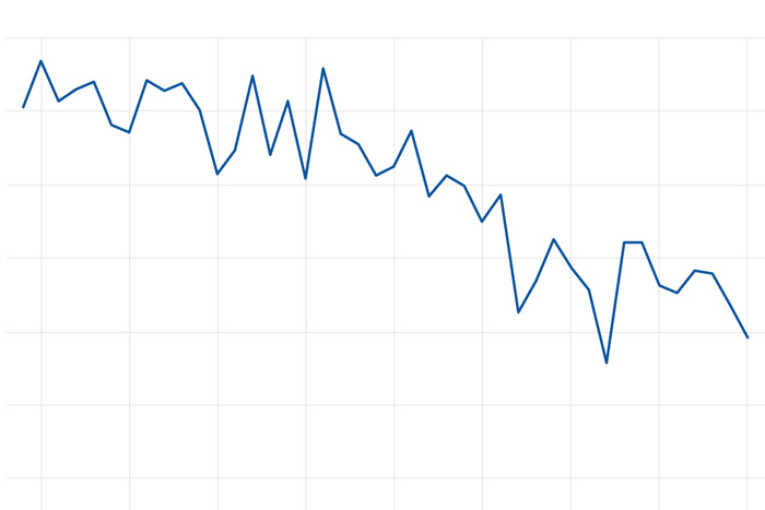
The amount of sea ice that survives the Arctic summer has declined by 12 percent per decade since the start of the satellite record in 1979.
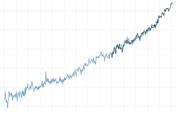
Earth's surface temperature has risen about 2 degrees Fahrenheit since the start of the NOAA record in 1850. It may seem like a small change, but it's a tremendous increase in stored heat.
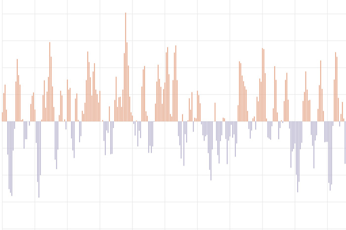
The Arctic Oscillation (AO) refers to an atmospheric circulation pattern over the mid-to-high latitudes of the Northern Hemisphere. The most obvious reflection of the phase of this oscillation is the north-to-south location of the storm-steering, mid-latitude jet stream.
The Southern Oscillation Index tracks differences in air pressure between the eastern and western sides of the tropical Pacific.
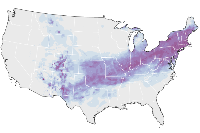
At least once a winter, a storm big enough to dominate the national news gets people wondering how to make extreme snowstorms make sense in the context of global warming.