Our most requested El Niño and La Niña images
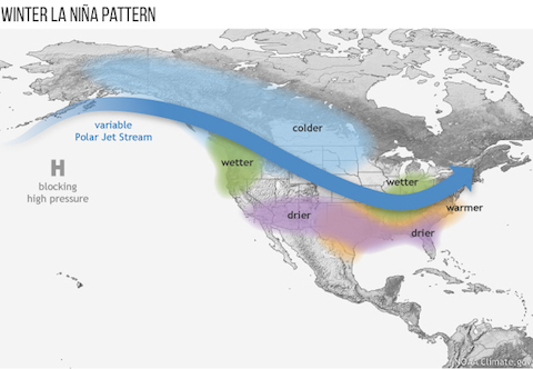
Last week, NOAA issued a La Niña watch, indicating conditions are favorable for the development of La Niña this winter. What does a La Niña winter typically mean for the U.S.?
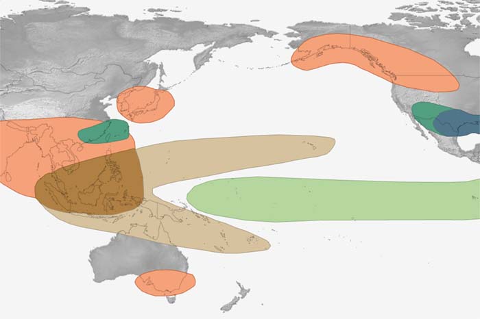
The disruptions of tropical Pacific sea surface temperature and rainfall that occur during the climate pattern called "ENSO" trigger a cascade of global side effects. These maps show how El Niño and La Niña affect seasonal climate around the world.
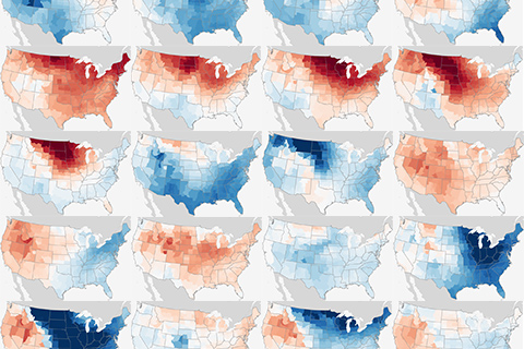
Does El Niño have a predictable influence on winter temperatures where you live? Check the maps!
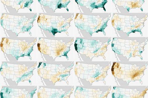
Does El Niño have a predictable influence on winter precipitation where you live? Check the maps!
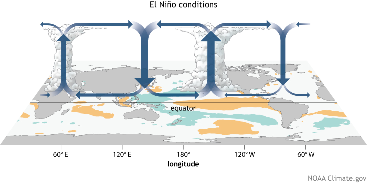
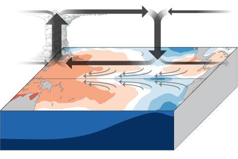
How do changes in the equatorial Pacific Ocean impact places much farther away? The answer for the tropics, at least, lies in changes to the equator-wide atmospheric circulation called the Walker Circulation.
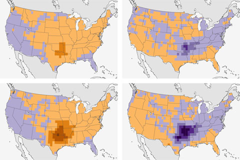
Scienitsts find connection between El Niño and fewer spring tornadoes in the south-central United States.
Though ENSO is a single climate phenomenon, it has three states, or phases, it can be in. The two opposite phases, “El Niño” and “La Niña,” require certain changes in both the ocean and the atmosphere because ENSO is a coupled climate phenomenon. “Neutral” is in the middle of the continuum.
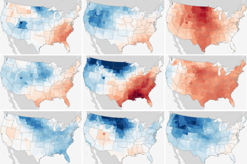
Does La Niña have a predictable influence on winter temperatures in your area? Check the maps!
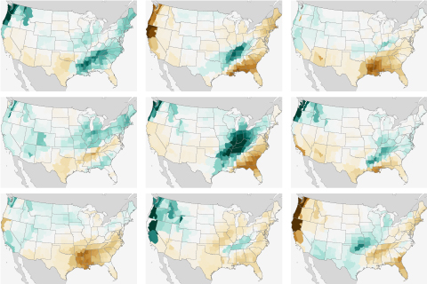
What were precipitation amounts during winter like across the U.S. during every La Niña on record? We've got the answer right here.
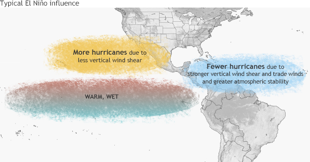
El Niño typically favors stronger hurricane activity in the central and eastern Pacific basins, and suppresses it in the Atlantic basin. Where does that leave the 2014 hurricane outlook?
Breadjerknes feedback.... wait, I'm sorry, I mean *Bjerknes* feedback, and how it helps El Niño and La Niña events to grow.