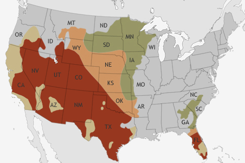
NOAA's Climate Prediction Center released its Spring Outlook on March 21. The big story for the upcoming spring? Relief for many drought-stricken areas of the United States is not likely.
NOAA's Climate Prediction Center released its Spring Outlook on March 21. The big story for the upcoming spring? Relief for many drought-stricken areas of the United States is not likely.
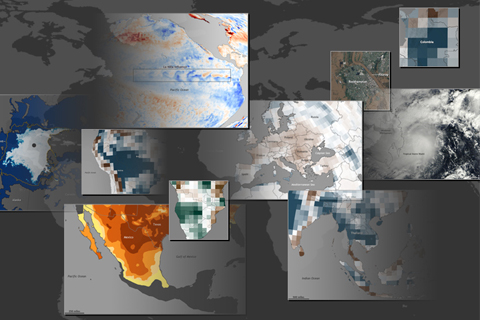
According to NOAA scientists, 2011 was a record-breaking year for climate extremes, not just in the United States, but around the world. Here's an illustrated guide to the year's top ten global climate and weather events.
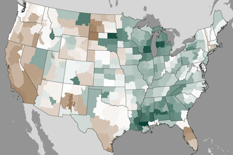
Winter storms in February improved drought in the Southeast and Midwest, but well below average precipitation in parts of the West in recent months has worsened drought in other places.
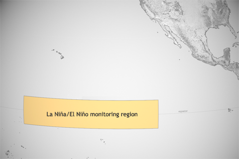
As the whole ocean gets warmer, NOAA scientists must redefine what they consider “average” temperature in the central tropical Pacific, where they keep watch for El Niño and La Niña.
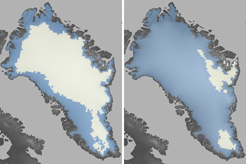
The summer of 2012 brought Greenland far more extensive melt than anything observed in the satellite record: in July 2012, surface melt extended over nearly the entire ice sheet. The standardized melt index was nearly double the previous record.
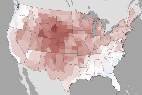
A scorching July contributed to the third hottest summer on record for the contiguous United States. Most of the U.S. was also drier than average. Rains from Isaac did little to relieve drought.
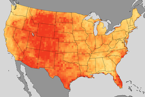
Imagine heat waves like the one last July coming more often & lasting longer: that’s the projection from climate models for the middle of this century based on one future emissions path.
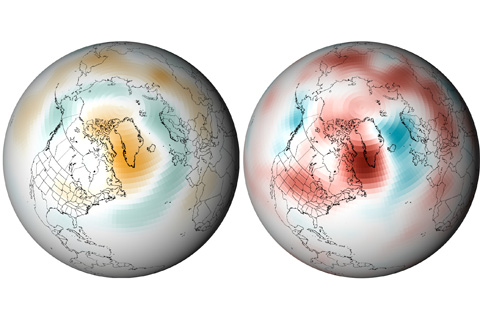
A series of unusually strong, long-lasting high pressure systems has parked over Greenland this summer. As many a weather forecaster has explained, high pressure generally leads to calm winds and sunny skies, both of which boost temperatures during the all-day sunshine of mid-summer at high latitudes. The conditions contributed to widespread melting of the ice sheet.
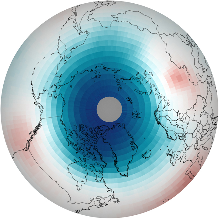
In the spring of 2011, scientists observed the largest, most severe ozone destruction ever witnessed in the Arctic since records began in 1978, due in part to the fact that CFCs stick around in the atmosphere for a very long time. Climate maps reveal the cause to be unusually persistent cold temperatures.
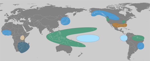
The lead character in the 2011 climate story was La Niña—the cool phase of the El Niño-Southern Oscillation—which chilled the central and eastern tropical Pacific at both the start and the end of the year. These natural cooling events have a long reach: many of the big climate events of 2011, including famine-inducing drought in East Africa, an above-average hurricane season in the Atlantic, and record rainfall in many parts of Australia, are common “side effects” of La Niña.