Blogs
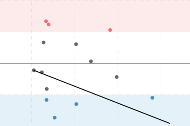
As the strong El Niño begins weakening later this winter and spring 2016, some clever folks may wonder whether La Niña conditions might develop in the second half of the year. The figure below shows the variations of the 3-month average sea surface temperature departures from average (the anomaly) in the Niño3.4 region, using the ERSSTv4 data (footnote 1).
You can see that sometimes La Niña does occur the year after a significant El Niño, like after the El Niño events of 1997-98, 1972-73 and 2009-10. But it doesn’t always happen, such as after the events of 1991-92 and 2002-03.
Can we estimate how likely a switchover is from an El Niño to a La Niña for the following year? And does …
Read article
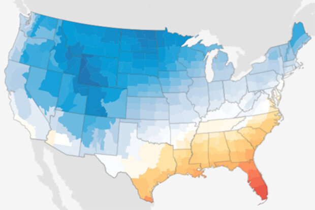
Welcome back—belatedly—from the holidays. For those of us east of the Mississippi, it didn’t feel like the holidays. Well, it did feel like a holiday—Memorial Day, maybe. In fact, for some of us, the weather felt a lot more like Memorial Day than the holidays we celebrate as the year closes.
The year ended with an unprecedented warm run in the United States. The last 5-6 weeks of 2015 were very warm east of the Rockies. But how unusual was it?
Just how warm, nationally?
On a national scale, December was both the warmest and wettest December on record for the contiguous United States, or CONUS. That in itself is a feat. It’s the first time since the CONUS record reached statistic…
Read article
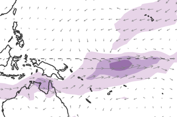
Happy New Year! December was an action-packed month, El Niño-wise. We’ll take a look at what happened in the tropical Pacific and around the world.
Out with the old
El Niño put up some pretty impressive numbers in December. The Niño3.4 index, which compares ocean surface temperatures in the east-central Pacific to the long-term average, broke the record in December, coming in at 2.38°C above average, surpassing December 1997’s 2.24°C. (This is using the ERSSTv4, the most historically consistent sea surface data we have.)
El Niño is ultimately measured on seasonal timescales, though, so the average of the sea surface temperature anomaly (departure from the long-term average) over thr…
Read article
For the first time ever my extended family did our Christmas gift exchange outside on my aunt’s patio in the Washington DC area. We did our best imitation of a Florida vacation: We abandoned hot cider in favor of tropical beverages. Some of us wore t-shirts and sandals. We played catch with the dogs. Jimmy Buffet stopped by. Okay, maybe not, but it was still totally awesome.
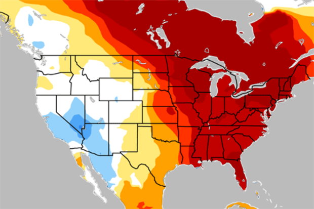
But, what on earth was going on with the weather? Let’s zoom out and look at November and December together because they were fairly similar. As you can see below, temperatures were strongly above-average across much of North America (shown by the yellow/orange/red s…
Read article
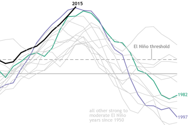
If you’ve been following the development of this El Niño, you may have heard in the media that sea surface temperatures in the central equatorial Pacific are at near-record highs. Are we seeing the most powerful El Niño ever?
Remember: ENSO is not all about the ocean
El Niño is one phase of the El Niño-Southern Oscillation (ENSO). An ENSO event involves changes in both the sea surface temperatures and in the overlying atmosphere across the tropical Pacific. In the case of El Niño, sea surface temperatures are warmer than average, and the Walker Circulation, which operates like a vertical loop through the tropical Pacific atmosphere—is weakened. This weakness shows up as more clouds and…
Read article