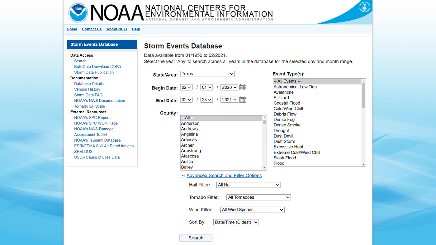
Comprehensive records describing 48 different types of severe events, from localized thunderstorms, tornadoes, and flash floods to regional events such as hurricanes, derechos, and winter storms.
Comprehensive records describing 48 different types of severe events, from localized thunderstorms, tornadoes, and flash floods to regional events such as hurricanes, derechos, and winter storms.
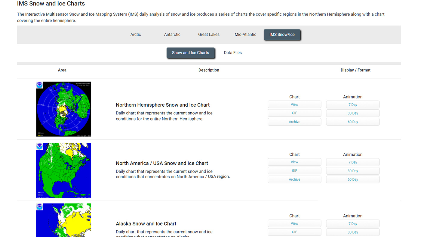
Daily maps, charts, and animations show the extent of snow and ice over the contiguous United States, Alaska, or the whole Northern Hemisphere.
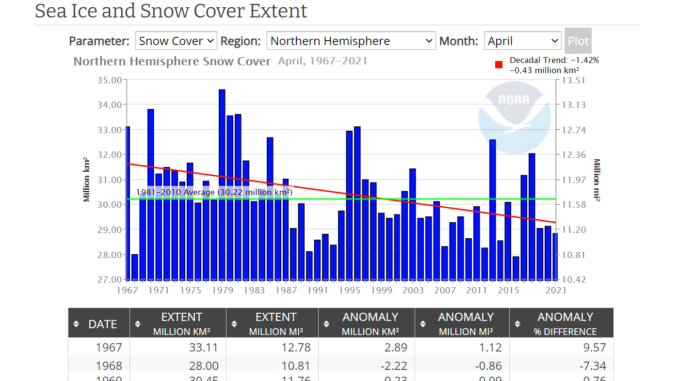
This tool generates bar graphs showing monthly extent of sea ice in the Northern or Southern Hemisphere, or for the entire globe.
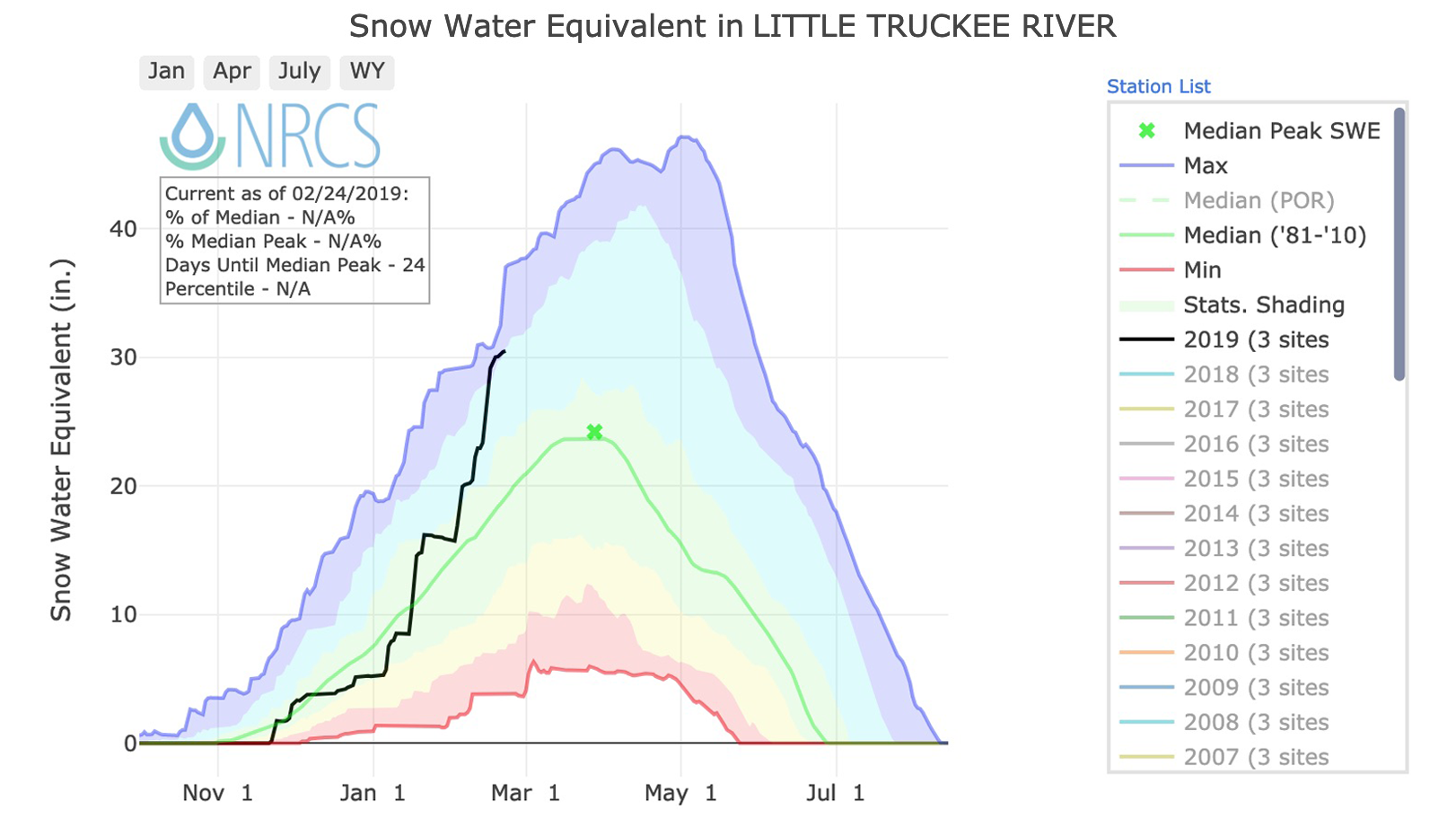
Generate graphs that show cumulative snow water equivalent in river basins in western states of Alaska, Arizona, California, Colorado, Idaho, Montana, New Mexico, Nevada, Oregon, Utah, Washington, and Wyoming.
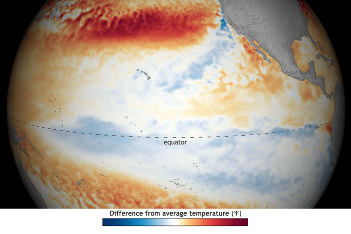
Colors on this map show where and by how much monthly sea surface temperature differed from long-term average (1985-1993, details from Coral Reef Watch). Red areas were warmer than average, and blue…
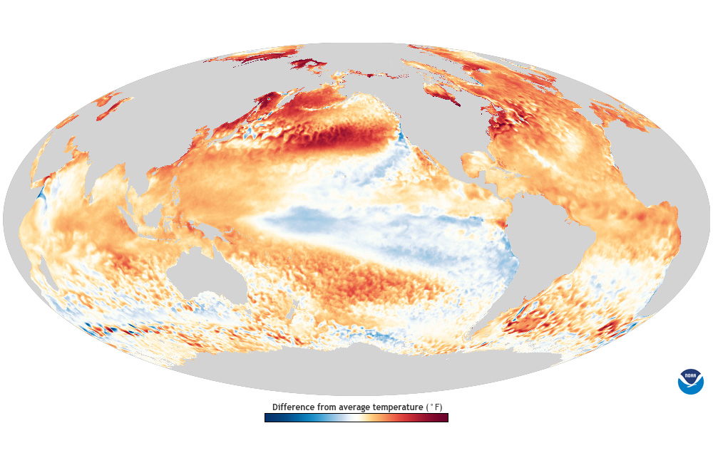
Colors on this map show where and by how much monthly sea surface temperature differed from a long-term average (1985-1993, details from Coral Reef Watch). Red and orange areas were warmer than…
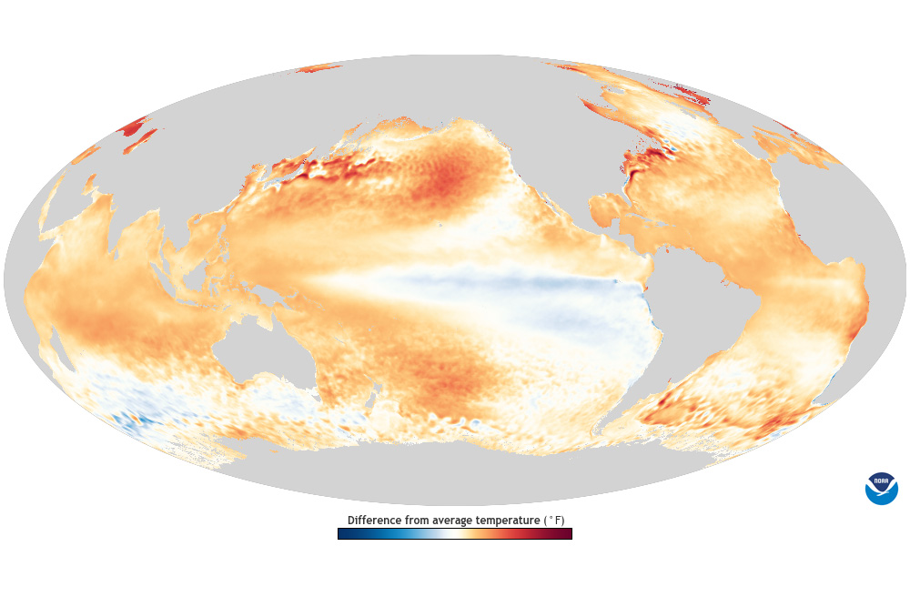
Colors on this map show where and by how much annual sea surface temperature differed from a long-term average (1985-1993, details from Coral Reef Watch). Red and orange areas were warmer than…
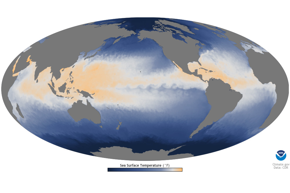
Colors on the map show the temperature of water right at the ocean’s surface. The darkest blue shows the coldest water: floating sea ice is usually present in these areas. Lighter shades of blue show…
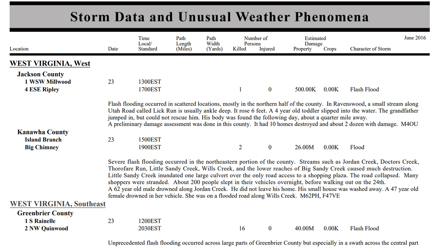
Monthly publication containing a chronological listing, by state, of storms and unusual weather phenomena. Reports contain information on storm paths, deaths, injuries, and property damage.
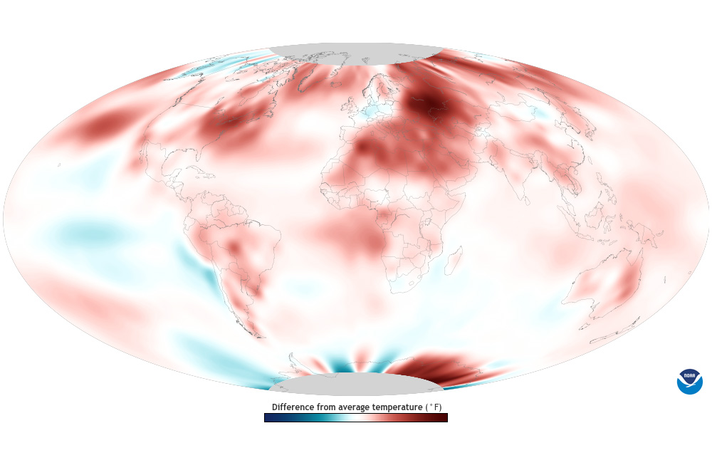
Colors show where average monthly temperature was above or below its 1991-2020 average. Blue areas experienced cooler-than-usual temperatures while areas shown in red were warmer than usual. The…