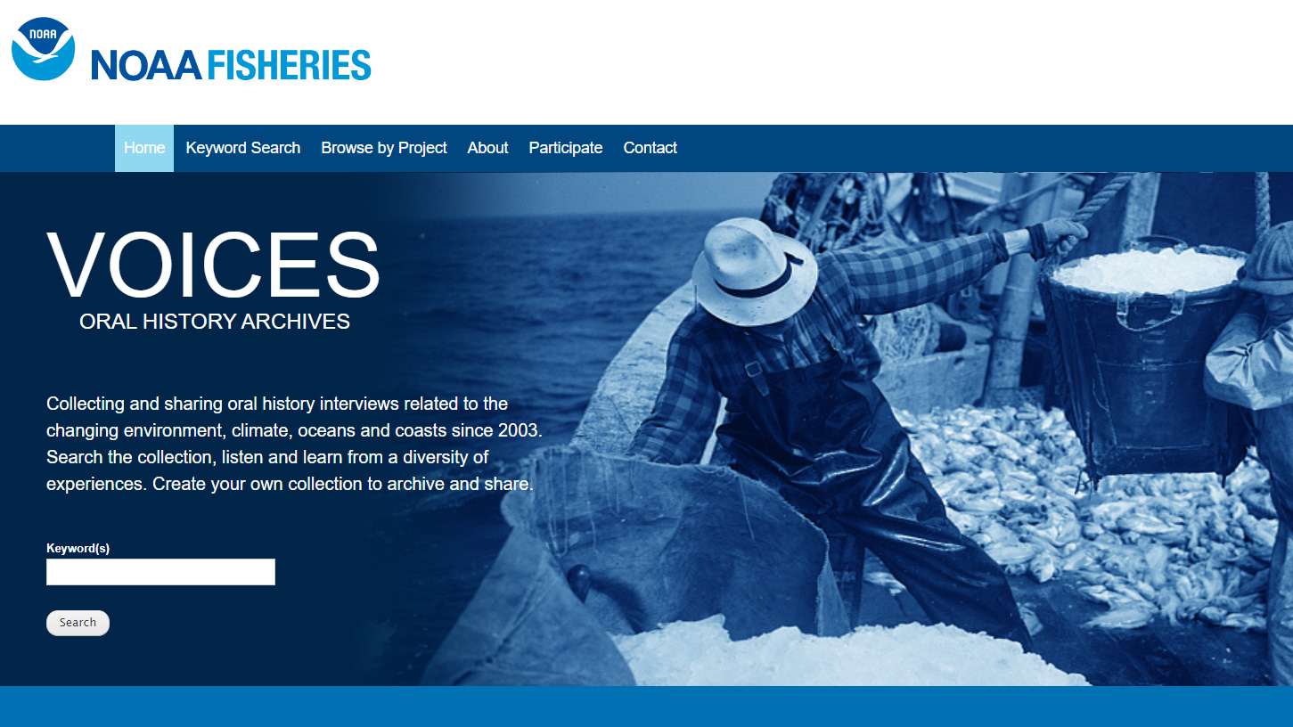
A digital archive of oral history interviews related to our changing environment, climate, oceans, and coasts. The entire database houses nearly 2300 unique oral histories as part of 118 distinct collections.
A digital archive of oral history interviews related to our changing environment, climate, oceans, and coasts. The entire database houses nearly 2300 unique oral histories as part of 118 distinct collections.
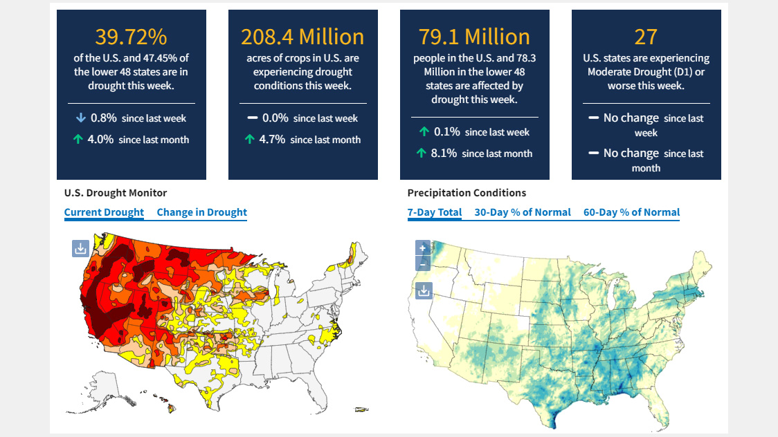
A one-stop shop for current, reliable, and useful information and resources related to drought conditions and associated risks.
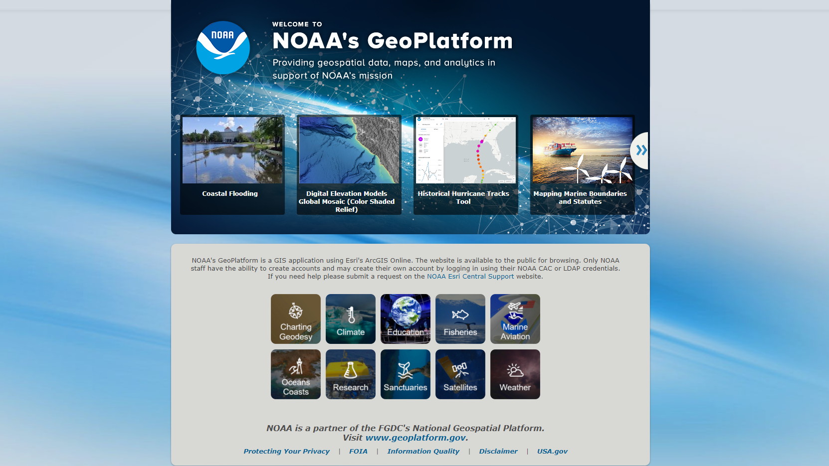
NOAA's Geoplatform provides geospatial data, maps, and analytics in support of NOAA's mission through a GIS application using Esri's ArcGIS Online. Maps, Layers, Scenes, Apps, and StoryMaps are available to the public for browsing.
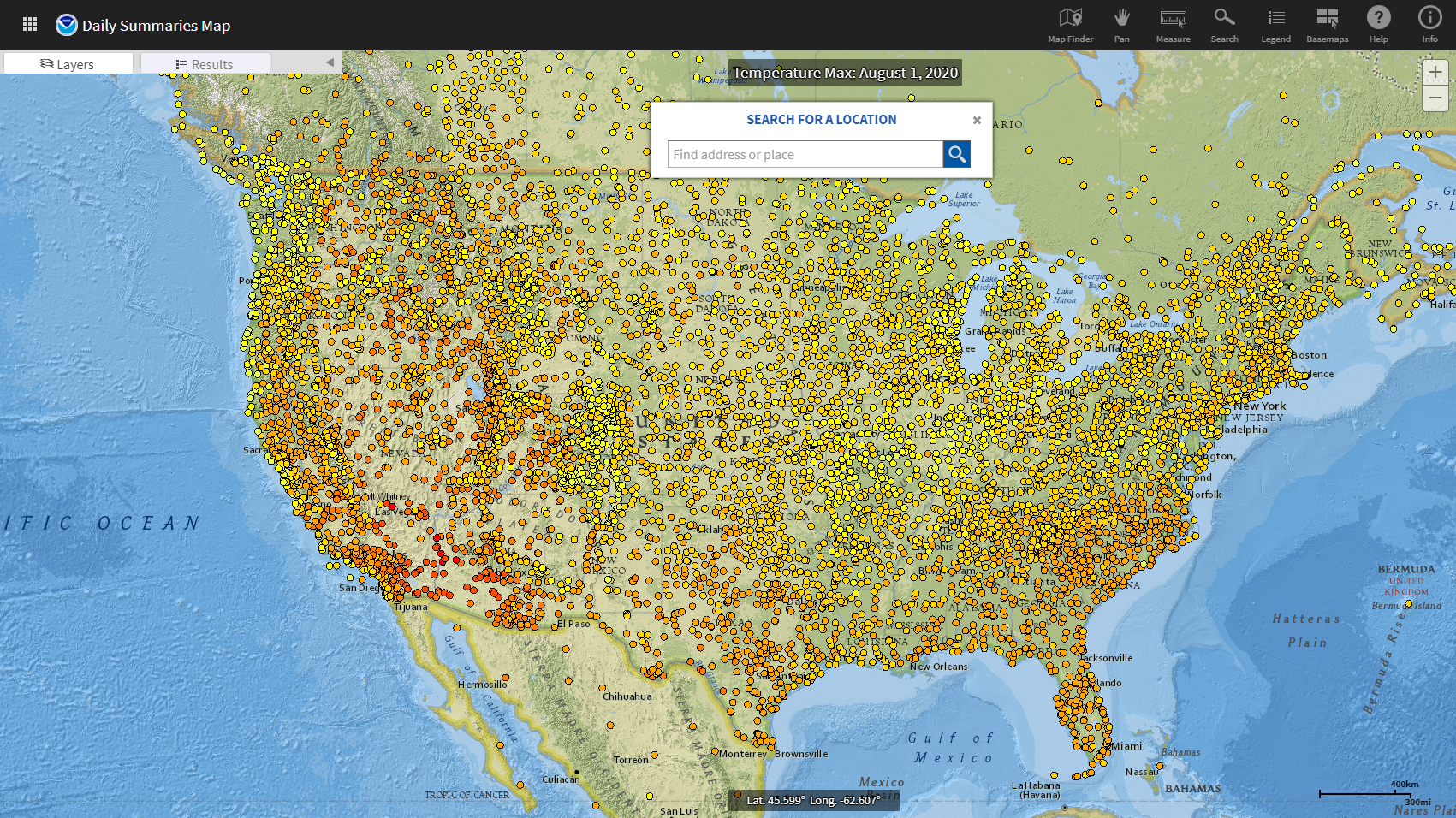
NCEI's Map Viewer Application presents a map interface to help users find, preview, and download or order climate and weather data.
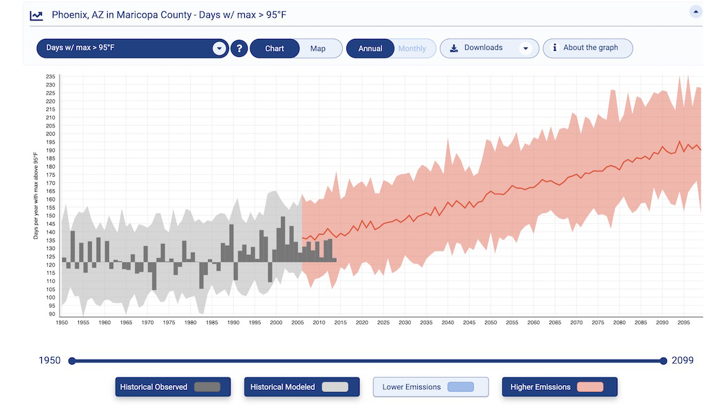
Check future climate projections for any county in the United States. View graphs or maps to compare future projections with observations from the recent past.
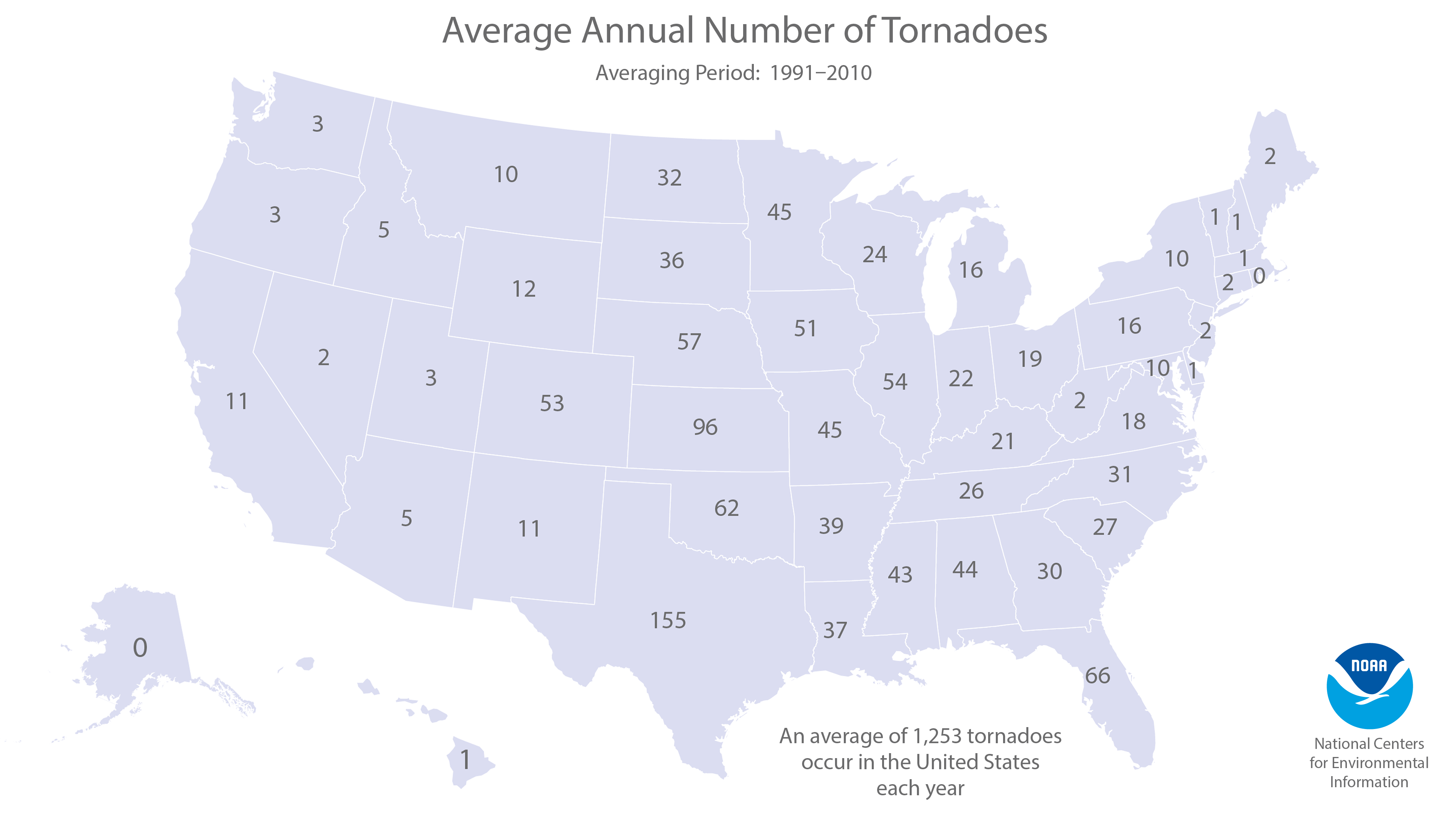
Graphs and maps show the number and locations of tornadoes reported each month since 1950.
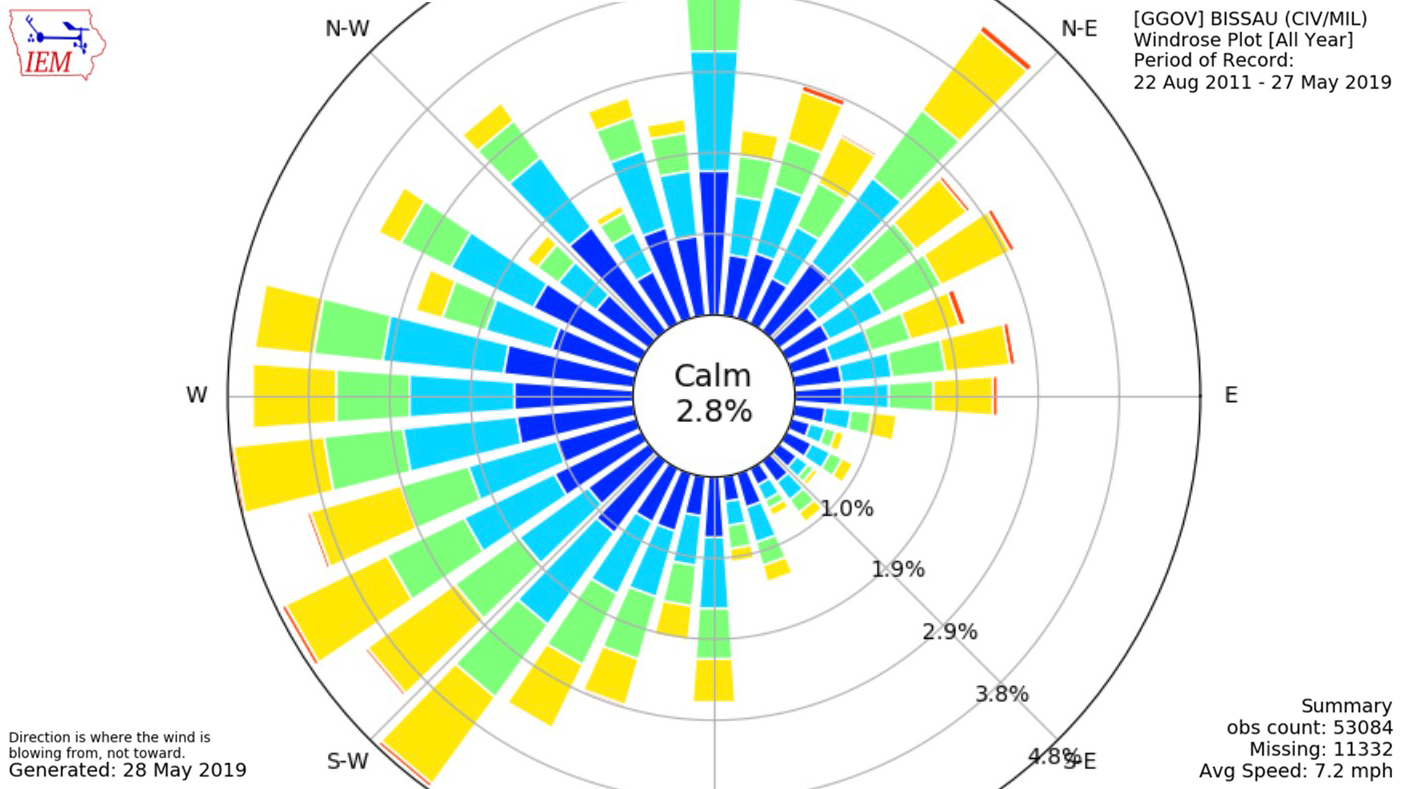
The Iowa Environmental Mesonet (IEM) lets you examine long-term records of wind speed and direction for many locations around the world.
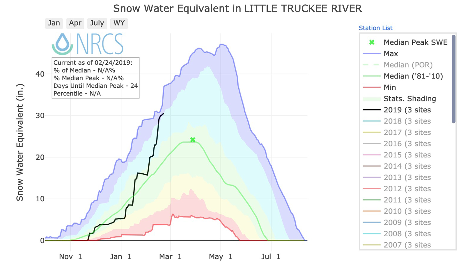
Generate graphs that show cumulative snow water equivalent in river basins in western states of Alaska, Arizona, California, Colorado, Idaho, Montana, New Mexico, Nevada, Oregon, Utah, Washington, and Wyoming.
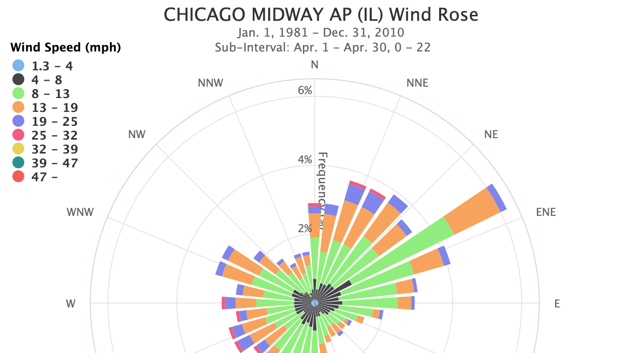
Wondering which direction the wind was from during your last cold snap, or which summer months usually have a breeze?
This site provides data tables for comparing record-setting conditions and Climate Normals at major U.S. weather observing stations in the United States.