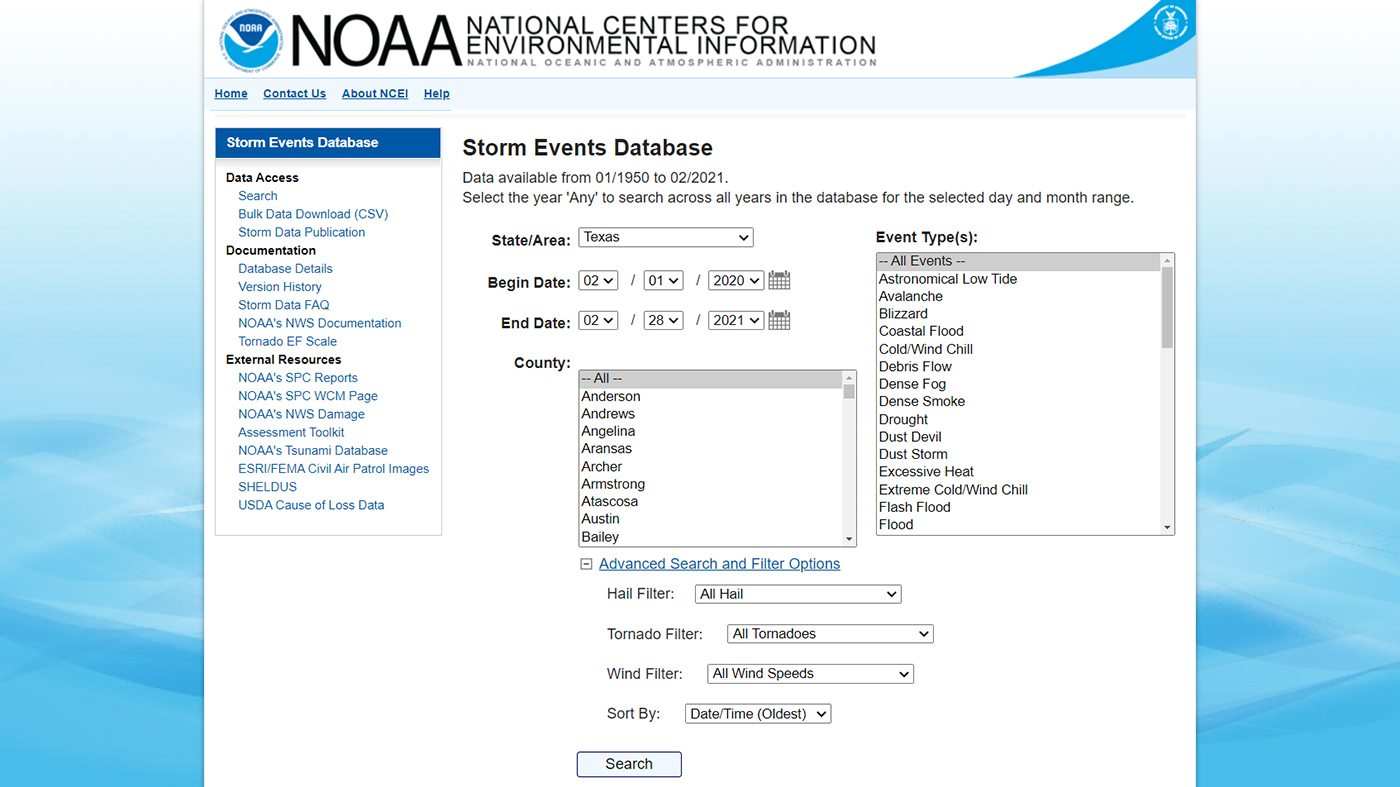
Comprehensive records describing 48 different types of severe events, from localized thunderstorms, tornadoes, and flash floods to regional events such as hurricanes, derechos, and winter storms.
Comprehensive records describing 48 different types of severe events, from localized thunderstorms, tornadoes, and flash floods to regional events such as hurricanes, derechos, and winter storms.
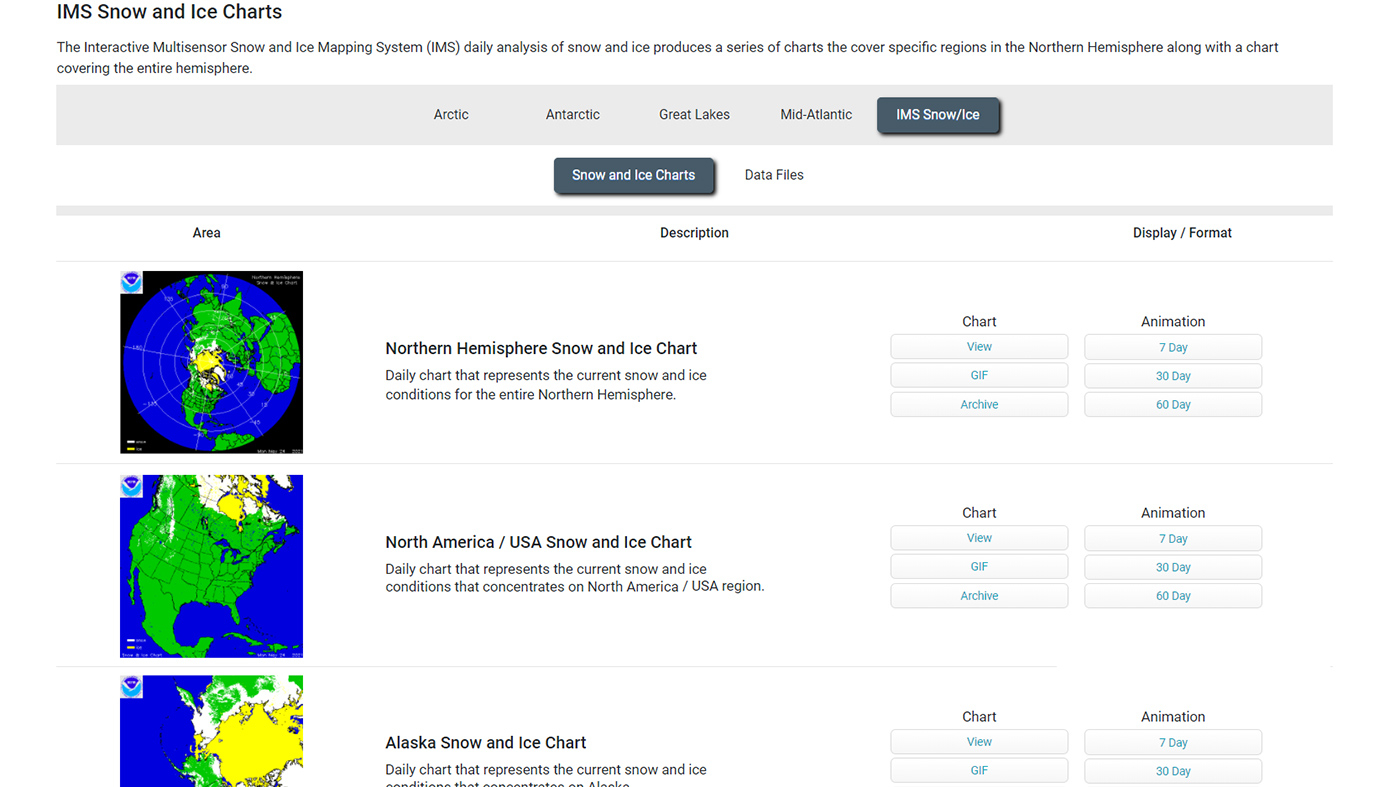
Daily maps, charts, and animations show the extent of snow and ice over the contiguous United States, Alaska, or the whole Northern Hemisphere.
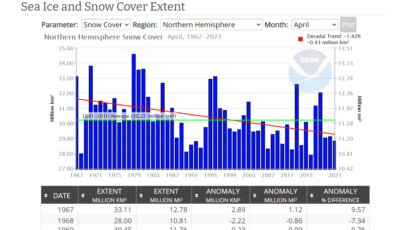
This tool generates bar graphs showing monthly extent of sea ice in the Northern or Southern Hemisphere, or for the entire globe.
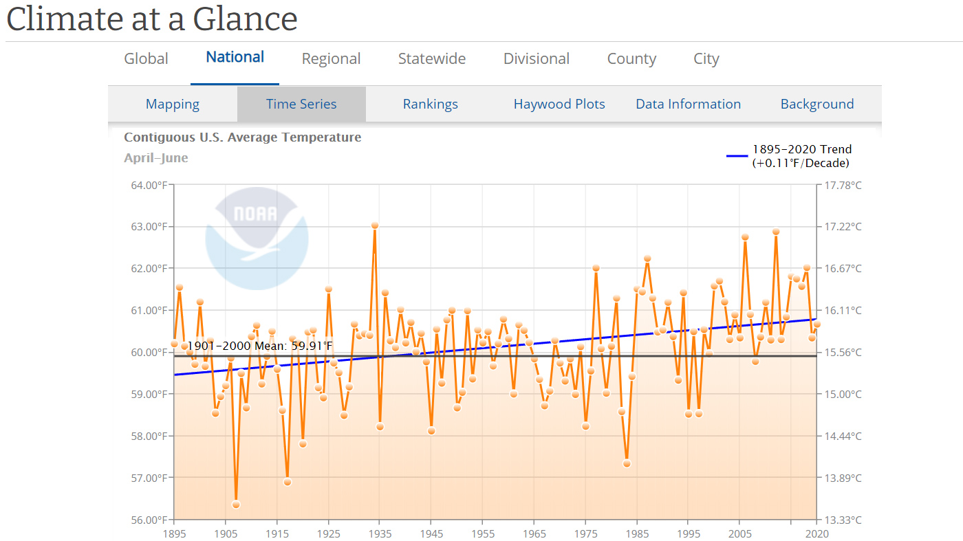
Historical records of U.S. temperature and precipitation as graphs, giving you a way to see how they have changed over time.